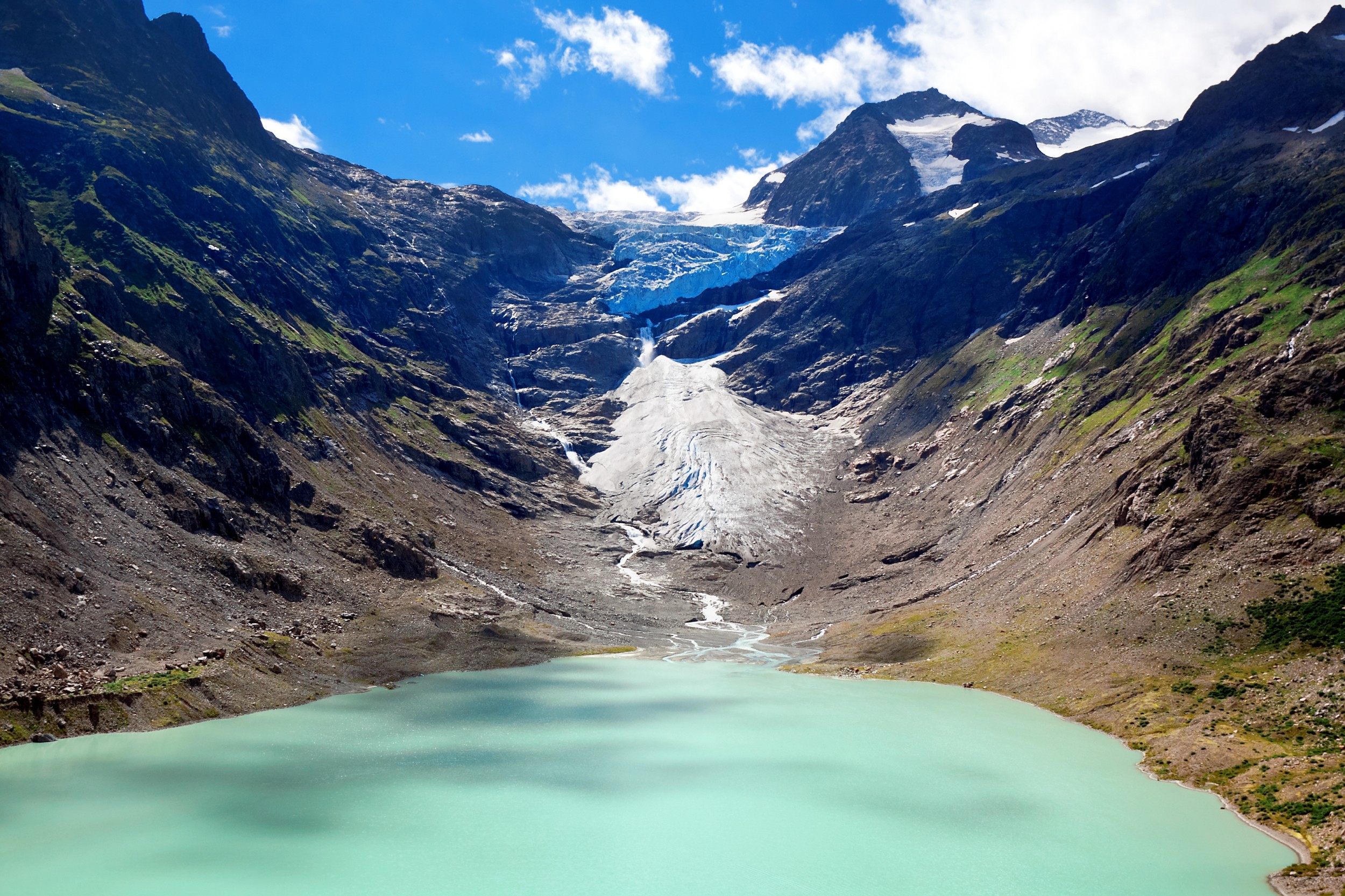
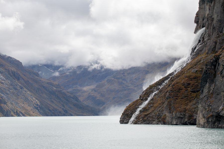
Where there was once ice with a thickness of hundreds of metres, reservoirs could in future store water so that turbines can use it to generate electricity. Retreating glaciers in the Alps are leaving behind areas that would be suitable for storage power stations – especially because in some cases natural lakes are forming here. This is an opportunity for Energy Strategy 2050, as this specifies an expansion of hydropower in Switzerland: up to 2035, electricity production should be increased by 1.1 terawatt hours a year. This can be achieved through the expansion of existing plants, the heightening of dams as well as new hydropower plants in high Alpine regions. However, where melting glaciers leave behind ice-free gravel plains, the water carries along more debris and sand. These are deposited in the reservoirs, reducing their volume and making energy production more difficult. Knowledge about the erosion processes beneath and above a glacier is therefore important for the planning of new reservoirs.
Reservoirs where glaciers once were?
Energy Strategy 2050 plans an expansion of hydropower in Switzerland. In addition to the heightening of existing dams and improved efficiency, new reservoirs for the production of hydropower could also be created beneath glaciers. How many such reservoirs would be required and where could they be established?
At a glance
- Retreating glaciers are releasing areas that could be used as possible sites for reservoirs, especially as natural lakes often already emerge here.
- Additional water catchments and reservoirs in glacier forelands would be an option for realising the energy generation objectives stipulated under Energy Strategy 2050 with hydropower.
- With seven new power plants at high Alpine sites, an additional 1.1 terawatt hours (TWh) could be produced each year. The energy content of the new reservoirs, which is important for the winter months, would even total 1.3 TWh.
- The level of objection to such new infrastructures is likely to be considerable, however. This is because six of the locations are situated in protected areas.
- In addition to the lack of acceptance, there are also technical challenges. Glaciers transport large quantities of sediment that have to be taken into account during the planning of new power plants. Computer models from the research project help here.
Aerial shots show the change in terrain
In order to quantify which sediments the melt water of a glacier can carry away, the researchers analysed a series of aerial images of the Gries Glacier in the canton of Valais. The series comprises annual photographs of the area taken since 1986 when the glacier retreated from the Gries reservoir. On the basis of these images, the scientists created so-called digital terrain models that state a height above sea level for each point. By comparing the annual heights, they were able to determine the volume of material that had been eroded. This reveals that during the initial years relatively little material was washed away – less than 5,000 cubic metres per year. From the mid-1990s, however, this volume increased and reached its maximum between 2011 and 2012 when 20,000 cubic metres was washed away each year – much of this as small particles in the so-called suspended load. After this time, the quantity washed away declines once more and the glacier foreland appears to have been stabilising since this time.
However, the melt water does not only contain sediments from the glacier foreland: even more material is eroded directly beneath the glacier. In the case of the Gries Glacier, weather analyses revealed that 70 % of the sediments originated from beneath the glacier. In order to obtain a more precise picture of what quantity of material is released during the course of the year and whether there are differences between glaciers, the researchers installed measurement devices beneath glaciers in Valais – the Aletsch Glacier and the Gorner Glacier. After two years, it was observed that the largest glacier in the Alps, the Aletsch Glacier, had eroded around 325,000 cubic metres of rock, while the figure for the smaller Gorner Glacier was approximately 60,000 cubic metres. More precise analyses indicate that it is not only the size of the glacier that is decisive for the amount of sediment, but rather also other factors such as the volume of melt water and the course of the seasons.
The collected data helped the researchers to create a computer-based model of the sediment transportation. This enabled them to simulate what happens during the retreat of the glacier: it was shown that there is an increase in the sediment load but that after a certain time the quantity declines despite additional melt water. This is linked to the availability of sediments that can be transported by the water.
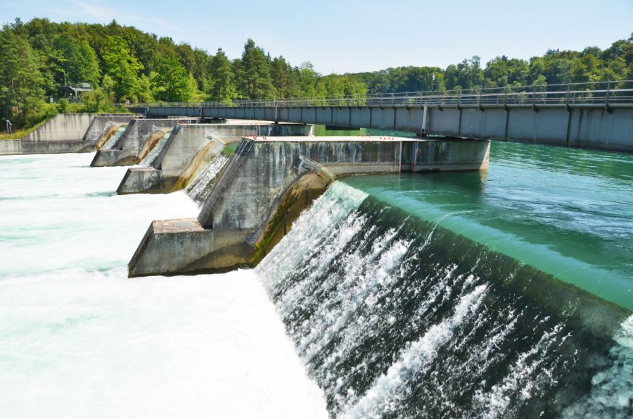
Sediments in reservoirs
If a power plant operator was therefore to build a dam beneath a glacier, this would not only dam the water, but rather also capture the sediment. Over time, this would lead to the silting up of the reservoir. Here, the researchers collected data at various reservoirs located close to glaciers and used it to create a computer model that simulates the silting up of a reservoir. In a study, they calculated how long it would take until a potential reservoir situated beneath the Gorner Glacier would be completed filled with sediment. The result suggested that it would take around 800 years until the reservoir was completely silted up. However, the operation of the hydropower plant would be put at risk at a much earlier time. This is because a great deal of sediment would be deposited close to the barrier and more of it would reach the turbines.
During the planning of future reservoirs, the problem of sedimentation must therefore be addressed at an early stage. This is because each location has its own peculiarities that need to be considered. With the new model, an efficient planning tool is now available.
Where could new reservoirs be built?
The scientists also focussed on the question of beneath which glaciers new reservoirs could be built. To this end, they used average discharge projections from several global climate models for 1,576 Swiss glaciers. They then selected those glaciers with an annual discharge volume of at least 10 million cubic metres of water. This left 62 glaciers, which were subsequently analysed and assessed with respect to 16 criteria from the areas of the environment, the economy and society.
Result: the additional requirement of 1.1 terawatt hours of electricity per year as stated under Energy Strategy 2050 could be covered with seven additional reservoirs and hydropower plants that achieved the highest score. The highest-scoring glaciers were as follows:
- Aletsch Glacier
- Gorner Glacier
- Grindelwald Glacier
- Hüfi Glacier
- Rhone Glacier
- Roseg Glacier
- Trift Glacier
With the exception of the Trift Glacier, however, all are situated at sites in the Federal Inventory of Landscapes and Natural Monuments (BLN). In principle, this does not make the construction of a power plant impossible – under the new Energy Act, the expansion of renewable energies is defined as a national interest and thus treated as equal to the protection of landscapes. However, significant resistance to possible infrastructures is to be anticipated in these untouched landscapes. There is also the fact that the high Alpine locations are situated in remote and difficult-to-reach areas, meaning that any possible construction would be costly. In the short term, the expansion of existing plants, for example through the heightening of dams, therefore appears more realistic. In particular, this would also allow for the gap that Switzerland is facing due to the phasing out of nuclear energy to be partially closed.
Products of this project
Contact and Team
Prof. Robert Boes
Laboratory of Hydraulics, Hydrology and Glaciology
ETH Zürich
Hönggerbergring 26
HIA C57
8093 Zürich
+41 44 632 40 90
boes@vaw.baug.ethz.ch

Robert Boes
Project direction

Ian Delaney

Daniel Ehrbar

Daniel Farinotti

Lukas Schmocker

David Vetsch

Mauro Werder
Sub-projects
This project is part of the joint project “Hydropower and geo-energy”.

All information provided on these pages corresponds to the status of knowledge as of 10.05.2019.